About
Origin story
Way back as a first year camper I was intrigued by the little green paddles and mountain ranges in the Trail Building. Do you remember that room between the counter where we packed out food for our trips and the window looking down the North Arm? So much adventure to imagine and anticipate there.
Over the years I have visited this room to remind myself of the whens and wheres my friends and family journeyed across the Far North. The plaques on the walls shared the names, some statistics, and a short description of their trip. But I wanted more.
So here it is. This site, at a minimum, seeks to make the walls of the TB available to those who cannot make the journey to camp. But I aspire to this being more than just words to read by collecting media (photos and slideshows), visualizing routes, and sharing historical highlights, family history, and amazing statistics. (Did you know that even with only 128 of the 355 trips recording mileage, camp has traveled close to 60,000 miles? And don't get me started about raisens.)
As always, if you have suggestions or comments, please contact me
~ Drew
Goals
- To collect and share for all Widji post high school trips:
- Routes to map
- Group photographs
- Sash and cap photographs
- Slideshows
Instructions
How to create a Google Map
- Requirement: You'll need a Google (or Gmail) account for this.
(Be sure you're logged in.) - On your computer, sign in to My Maps.
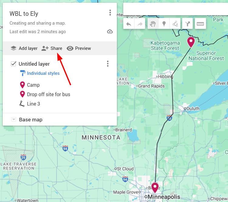
(It's possible to do this from your phone, but not recommended.) - In the top left click "CREATE A NEW MAP".
- In the top left click "Untitled map."
- Give the map a name (Year-Counselor) and description (more is better).
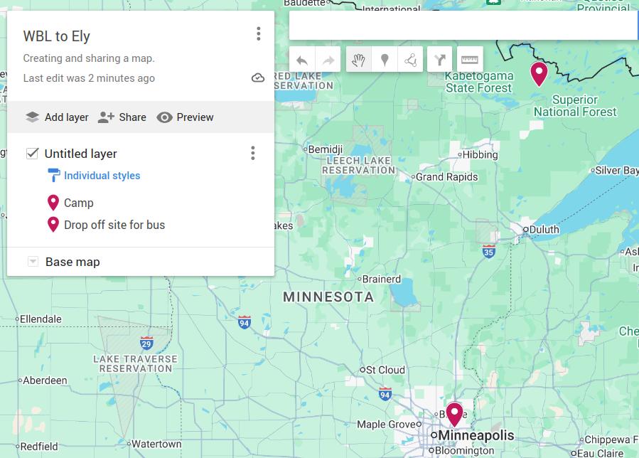
- Drag and zoom the map to the general area of your trip.
- Select the "Add line or shape" action per red arrows in image.
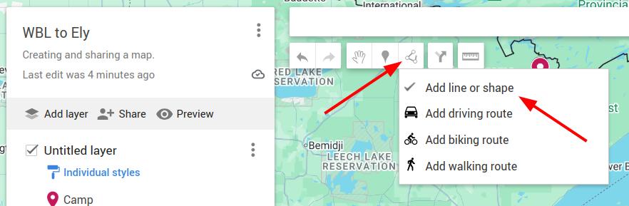
- Click once at the start point, then double click twice at the end point.
- I suggest starting with a simple straight line from beginning to end.
This tends to be the easiest method as most folks easily remember where they started and finished. The meandering in between can be the challenging part.
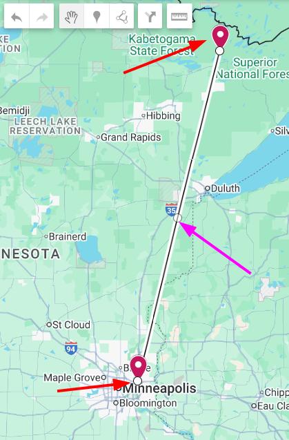
- You will find in the middle of the straight segments a small circle. (Red circles in the image.)
- Drag to a location you can identify.
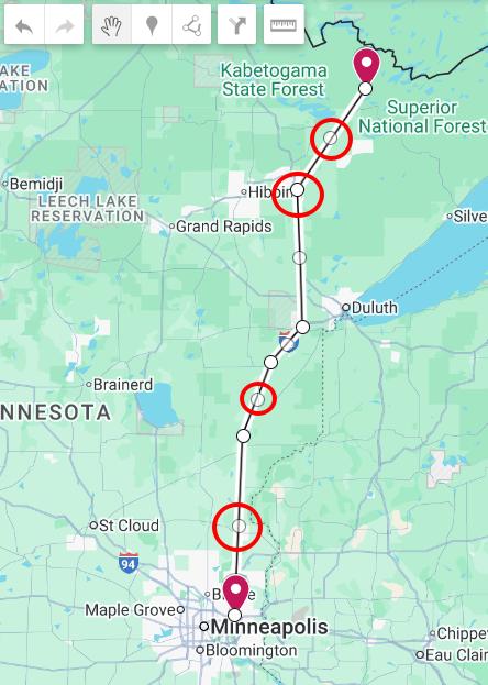
- You could stop here, but it'll look like you embarked on the insanest of portages. Or cheated by chartering a plane. : )
- Repeat the circle dragging at least a few more times. Remember, each line segment will have a circle to drag, so you can get as detailed as you'd like.
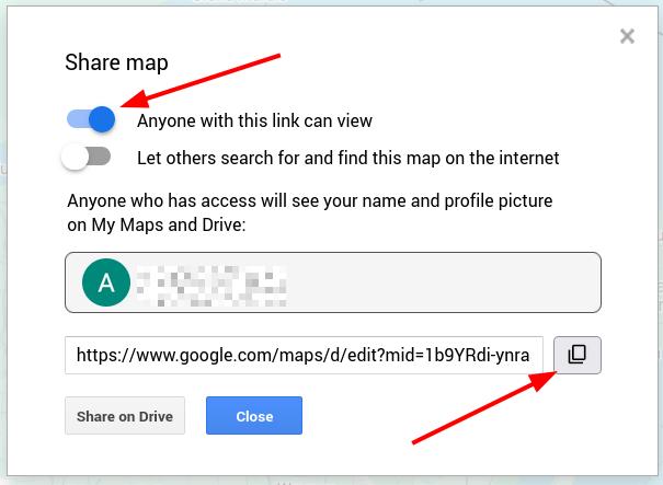
- Select "Anyone with this link can view".
- Copy the URL.
- Close.
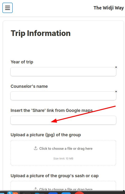
- On the Contact page, paste the map link into the "Insert the 'Share' link from Google maps" field on the "Trip Information" form .
- Be sure to identify the "Year of trip" and "Counselor" so I know which trip this map is associated with.
- If you leave your email, I'll try to notify you when it's been updated.
Other developments simmering over the fire
(To-Dos / Known bugs)
- Publish the canoe logs/histories for the woodies.
- Collect routes from Widji alumni adventures over the years.
- Bug fix for the timelines on mobile. (Currently only available via desktop.)
- Swap out map code on trip pages.
Tech stack
In case anyone is interested -
- Data for this site is currently maintained in Google sheets (exported as needed to update content here.)
- This site's pages are created with the static site generator Eleventy.
- Source code kept in Github.
- This site is hosted on Netlify.
- The code used for the Trail Building / Family History pages is a framework called Similie Exhibit.